The first of two fall trips to Arizona allowed us to get out in the Sedona and Scottsdale areas – both of which offer easy access to trails.
It’s been several years since we’ve met relatives in the Phoenix area, and in the past we’ve taken the opportunity to drive north to Sedona’s red rock country or south to Saguaro National Park and Tucson.
This time we arrived a day earlier than others, so spent the first night in Sedona. There, we went on short hikes to a natural bridge and around a spire to a rocky promontory. After that, we stayed in Scottsdale, which provided fairly easy access to parks. We hiked to the top of a peak on the edge of the valley one day, then I ran up the highest mountain in Phoenix the next morning.
Devil’s Bridge
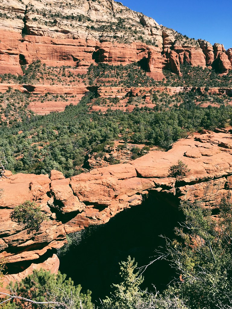
Devil’s Bridge is the largest natural arch in the Sedona area, and there are multiple routes leading to it. Because we were only in the area for one night, we chose the shortest trail to get a second hike in before leaving.
Starting from the Dry Creek Vista trailhead, we walked 1 miles northeast on the dusty, rutted Forest Road 152 to the official Devil’s Bridge trailhead. The road traveled up and down slightly with mountains of the Red Rock-Secret Mountain Wilderness rising to the southeast.
At the Devil’s Bridge trail, we turned east and continued uphill into the trees. After a final steep section, we reached the top of the 50-foot arch just inside the wilderness.
Devil’s bridge is sturdy enough to walk on and provides views across the canyon – it’s also a popular spot, and you won’t be alone. After waiting our turn to take photos of the arch, we hiked back to the trailhead the same way.
Here are more photos from Devil’s Bridge.
Distance: About 3.6 miles round trip.
Trailhead: From the intersection of Arizona Highway 179 and U.S. Highway 89A in Sedona, drive 3.2 miles west on 89A, 2 miles north on Dry Creek Road and 0.2 miles northeast on Forest Road 152 to the Dry Creek Vista trailhead. (If you have a high-clearance vehicle, you can continue 1.1 miles out the rough forest road to the Devil’s Bridge trailhead.)
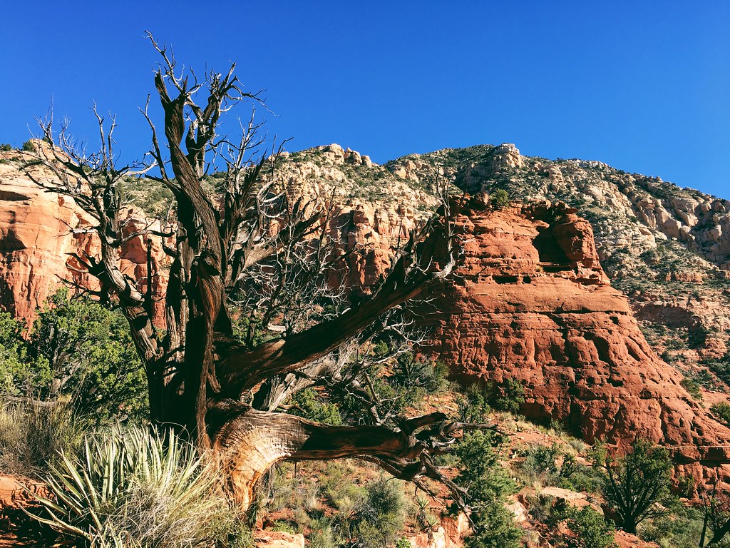
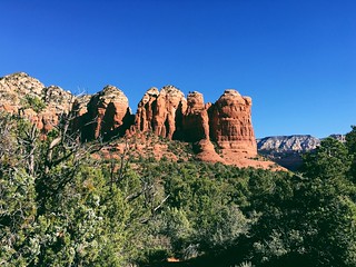
Chimney Rock-Sugarloaf
Our second hike before leaving Sedona linked several trails below the mountains on the north side of town.
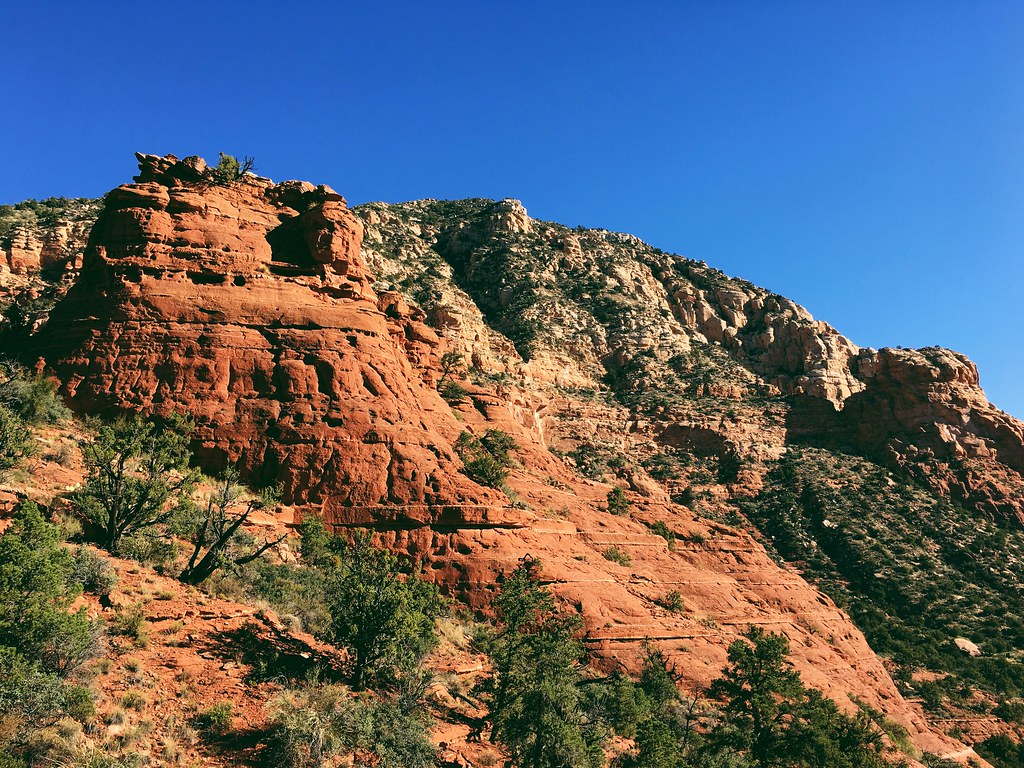
Starting from the Thunder Mountain trailhead, we hiked uphill to the northwest along the base of three-spired Chimney Rock and past two junctions. At a third junction at about 0.3 miles, we continued north for 0.5 miles, then turned east at a junction and climbed to Chimney Rock Pass, briefly entering the Red-Rock Secret Mountain Wilderness.
Down from the pass at about 1.2 miles, we continued west for 0.7 miles on the fairly open Thunder Mountain trail with Capitol Butte rising to the north. At a junction with the Adante and Teacup trails, we continued east on Teacup for 0.3 miles.
After crossing a wash, we turned southeast on the Sugarloaf Loop trail then again on the Sugarloaf Summit trail, climbing to the open top of the rock formation at 2.7 miles. The outcrop provided excellent views of town and the surrounding mountains, including Coffee Pot Rock.
Backtracking down Sugarloaf and west on the Teacup trail for 0.8 miles, we returned to the junction with the Adante trail and followed it west, slightly south of the Thunder Mountain trail, for 0.6 miles. Just past the Adante trailhead, we turned south along the base of Chimney Rock and continued about 0.5 miles back to where we started for 4.6 miles total.
Here are more photos from Chimney Rock and Sugarloaf.
Distance: About 4.6 miles round trip.
Trailhead: From the intersection of Arizona Highway 179 and U.S. Highway 89A in Sedona, drive 2.5 miles west on 89A, 0.6 miles north on Adante Drive, and 0.3 miles west on Thunder Mountain Road, then turn north into the Thunder Mountain trailhead.
Sunrise Peak
In Scottsdale, temperatures reached the mid-90s – on the high end for us – but they didn’t keep us from getting out as long as we carried plenty of water.
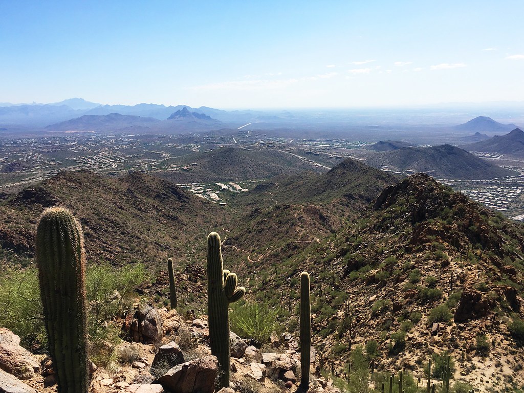
On our first full day there, we hiked to the top of 3,069-foot Sunrise Peak in the McDowell Sonoran Preserve to the northeast of the city. Even starting mid-morning, it was already well into the 80s.
From a parking area in a neighborhood at the east end of the trail, we climbed steeply and steadily northwest up a cactus-filled canyon. A ridge line above switchbacks at about 1.2 miles provided views across the Phoenix metropolitan area to the west.
Another 0.6 miles up, we reached a second viewpoint and a junction with the trail west to the top. After the final 0.25 miles of switchbacks to the top, we found shade under a small tree and views all around – the metro area to the west, farther into the preserve to the northwest, the Fountain Hills to the northeast and the Superstition Mountains in the distance to the east.
The route continued west to another trailhead, but with the temperature rising, we descended southeast back to our air-conditioned car.
Here are more photos from Sunrise Peak.
Distance: About 4.1 miles round trip.
Trailhead: From North Scottsdale Road, drive 8 miles east on East Shea Boulevard, 0.5 miles north on North 136th Street and 1.4 miles east on East Via Linda to the Sunrise trailhead.
Piestewa Peak
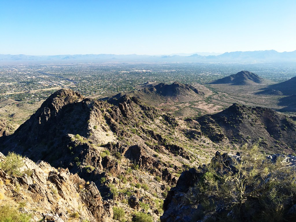
Before anyone else woke the next morning, I went on a sunrise run up Piestewa Peak in the Phoenix Mountains Preserve. At 2,608 feet, it’s the highest in the metropolitan area.
(The morning before, I tried the same run, but unknowingly started on the wrong trail and ended up on top of the wrong mountain. It was still fun.)
From the west side of the 40th Street trailhead parking area, I ran south across the desert floor on Trail 8 as first light reached the mountains to the west, passing a couple of junctions. Over a small saddle, I turned west then southwest, passed another junction and intersected Trail 304 at a pass at 2.7 miles
About 0.5 miles down the canyon from the pass, and past another junction and a trailhead, I turned onto Trail 302 and continued southwest. About 0.6 miles farther down the canyon, Trail 302 merged with Trail 300 – and I merged into a crowd – just above a popular trailhead for Piestewa Peak.
After the junction, the trail widened and was paved in places with steps. My pace slowed as I climbed, occasionally waiting to pass people.
The trail continued a short distance then turned north and split at about 0.5 miles. From there, I followed Trail 300 northeast, rounding a ridge line and scrambling up the final rocks to find a U.S. Geological Survey marker at 4.9 miles.

After taking in the surrounding view from the sunny summit and eating some food I brought along, I retraced my route back across the preserve in mid-80s heat.
Here are more photos of Piestewa Peak.
Distance: About 9.8 miles round trip.
Trailhead: The 40th Street trailhead is 4 miles east of North Scottsdale Road on East Shea Boulevard, the 1 mile south on North 40th.
