On our second trip to Arizona last fall – my first time to the Grand Canyon – we drove and took the opportunity to stop in southern Utah on the way.
Zion National Park is about the halfway point between Missoula and the South Rim, so we stopped there to camp for the night. The next morning, we left shortly after sunrise without hiking in the park because we planned to try a slot canyon between Kanab and Page, Arizona.
After stopping at the Bureau of Land Management office in Kanab to check conditions, we continued south to the Wire Pass trailhead in the Vermilion Cliffs National Monument.
There, we hiked through the through the Wire Pass slot canyon to Buckskin Gulch – which is said to be the longest and deepest slot in the Southwest at 13 miles and, in places, 400 feet, respectively.
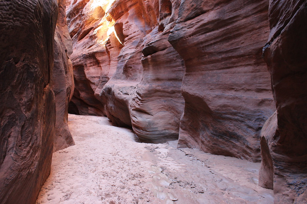
The first mile of the Wire Pass trail is rather plain – west down a dry wash surrounded by orange sandstone hills. Half a mile from the junction with Buckskin Gulch, however, the canyon walls soon close in.
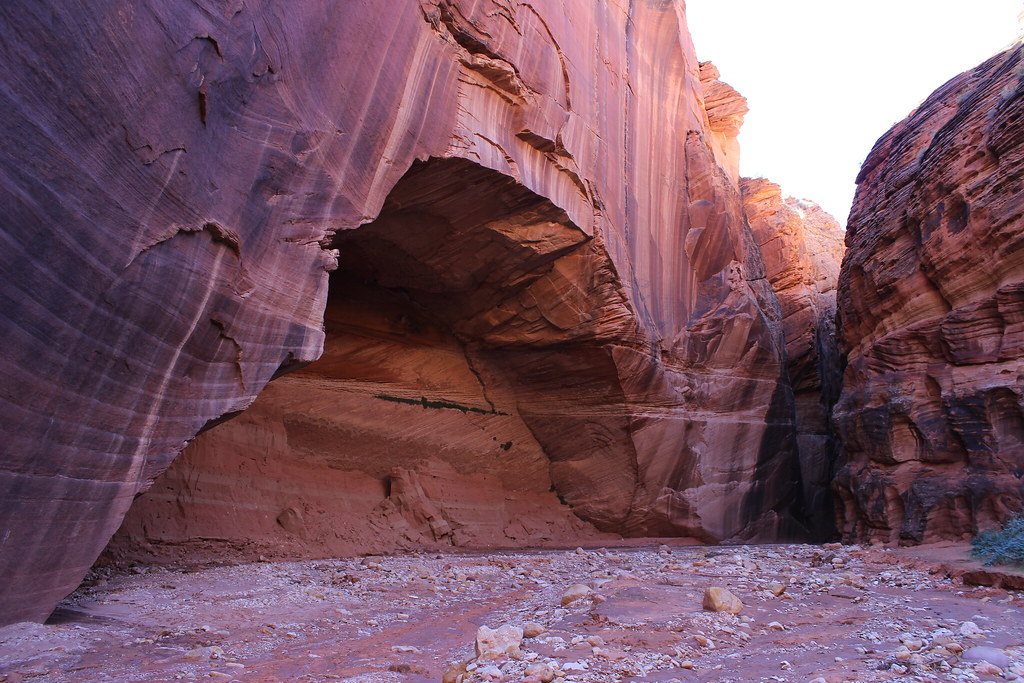
As we entered the slot canyon, we passed a couple who turned back disappointed after finding a 15- to 20-foot drop a short distance inside that likely requires a rope to descend. After a little looking around, however, we easily found a route over the top marked by rock cairns.
That one drop must prevent many people from continuing, as we saw only one other person beyond that point.
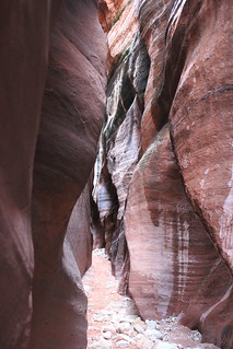
Before reaching the junction with Buckskin Gulch, we passed through the narrowest section of slot canyon we would encounter – a few feet wide, at most, with a sliver of sky visible high above us. At 1.7 miles, the canyon widens again at the junction. With GPS for the most part useless, we explored Buckskin Gulch based simply on time since we still had to drive to the Grand Canyon that day.
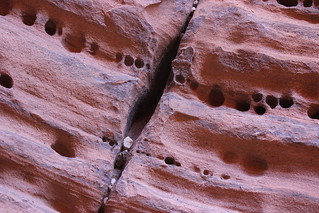
We followed Buckskin north first, the canyon walls varying from about 5 to 15 feet wide. Along the way, we found interesting patterns and pockmarks on the otherwise smooth sandstone, as well as a snake and a lizard.
After returning to the junction and following Buckskin east, it became apparent we should have gone that direction first – the canyon there is much narrower and more dramatic than the northern section. Unfortunately, we weren’t able explore much since we had to continue on our trip.
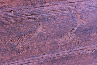
On the way out, we stopped to inspect rock art on a wall at the junction before making our way back up the Wire Pass trail.
Before reaching the trailhead, we encountered a group coming out of the Coyote Buttes area, where the well-known Wave feature can be found – but with permits required even for day use, we’ll have to return another time.
Here are more photos from Wire Pass and Buckskin Gulch.
Distance: The Wire Pass trail is 3.4 miles round trip to Buckskin Gulch. From the junction, the Buckskin Gulch Trail travels 4.5 miles north and 11.3 miles east; we explored a short distance in both directions.
Trailhead: The Wire Pass trailhead is 8.3 miles south on the rough House Rock Valley Road, of U.S. Highway 89 about 38 miles east of Kanab, Utah, and 34 miles west of Page, Arizona.
