Our farthest north in Iceland

siglufjordur_2015-02-16_160

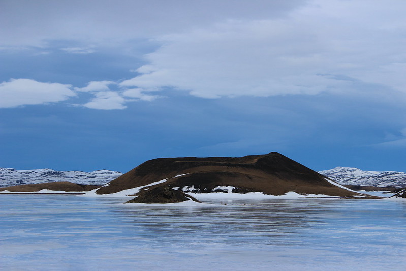
After visiting the Mývatn area, we turned back west to Iceland’s second largest city, Akureyri, on the western shore of Eyjafjörður.

Five kilometers above town, Hlídarfjall Ski Center is one of the country’s best ski areas, we read, with 20 kilometers of cross-country routes in addition to downhill runs. And February was known for having some of the best conditions.

Again, however, we couldn’t ski. The slopes looked awfully brown the day we arrived, and a Reykjavíkur staying at our guesthouse told us he had just come down from the ski center because it had closed due to high wind. We drove up to Hlídarfjall to take a look for ourselves, and from what we could tell only 5 kilometers of cross-country routes would be available if it opened the next day.

We decided to look for alternatives – possibly another place to ski, but more than likely somewhere to hike.

We drove north to Dalvík, where there was ferry service to Hrísey. Nature trails out of the island’s small village offered an option. Continuing northwest from Dalvík to Ólafsfjörður or Siglufjörður, on the Tröllaskagi Peninsula was another possibility. There were also trails leading up a valley above Akureyri, although we didn’t know how well they would be marked in winter.

akureyri_2015-02-16_005

Late that afternoon, we explored the shops, restaurants and bars of Akureyri’s small, pedestrian friendly downtown, just a block from our guesthouse. (Akureyri Backpackers, a hostel, had a restaurant and bar on the main level with a good beer selection and the best food options for vegetarians, so we ended up eating there both nights of our stay.)

The next day, we decided to continue north out the fjord and around the peninsula, which proved worthwhile.

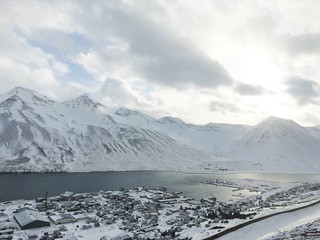
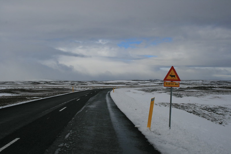
The drive to Siglufjörður itself is a scenic adventure. Near the north end of Eyjafjörður, the cliffside road turns west abruptly into a 4-kilometer tunnel through the mountains to Ólafsfjörður. On the other side of the town, the road travels through two more tunnels – 7 kilometers to a small fjord, then 4 kilometers more – to Siglufjörður. Exiting the tunnel, we found a much snowier landscape and a picturesque village. At 46 kilometers south of the Arctic Circle, this would be the farthest north we traveled on our trip.

siglufjordur_2015-02-16_177

Stopping at Sigló’s library, we learned of a network of trails up the side of the fjord on the town’s avalanche defense barriers and into a small valley above. While this seems counterintuitive, the avalanche “dams” were constructed with recreation in mind.

From the north end of town, we walked uphill south then turned back, eventually rising west into the valley above. During a brief but heavy snow flurry, we considered turning around. After waiting a short while, however, the conditions improved and we continued up the slope.

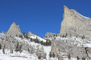
In the valley, we followed trail markers that were sticking out of the snow a short distance, then turned around and took in the town and fjord from above. At that point, the sun had broken through the clouds and revealed the peaks above the fjord. When we got back to our vehicle, we had covered about 7.5 kilometers – a good day out.

siglufjordur_2015-02-16_124

The next morning, after coffee and pastries at a downtown bakery, we made our second-longest and most remote drive of the trip, to Grundarfjörður on the Snæfellsness Peninsula.

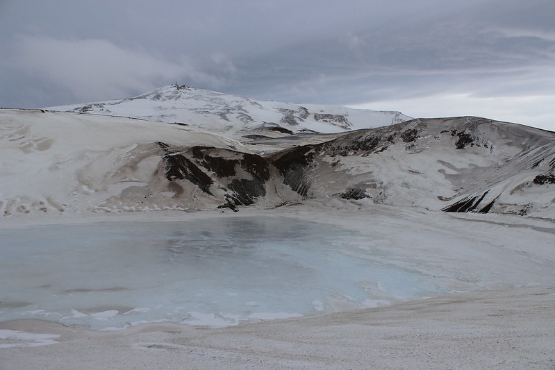
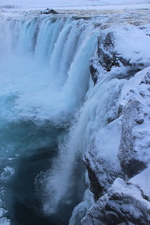
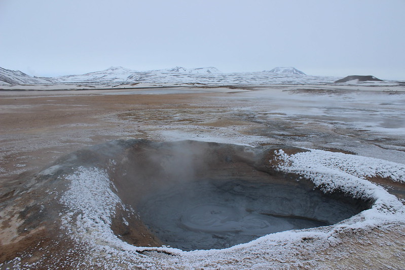
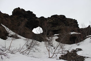
Here are more photos from Akureyri and Siglufjörður.

Advertisement

Little snow, lot of wind in Iceland’s Mývatn

krafla_2015-02-14_013

Our plan in traveling to Iceland in February was to cross-country ski, and since there was no extra fee on our flights we packed our own gear. It wasn’t to be, however.

The six-hour drive northeast from Reykjavík to the Mývatn area – our first destination outside of the capital – looked promising. The mountains and valleys along the way were white, and a stop at Goðafoss provided a frosty sight.

godafoss_2015-02-12_040

At our guesthouse just south of Reykjahlíð, we were told that while winter had been snowy it also was much windier than normal. In the lava field across the road, sharp, black rock was covered by only a thin layer of crusty snow. In fact, there was more on the ground the last time we visited.

While our skis stayed packed in our SUV, there were plenty of other options for getting out around Mývatn in winter.

hverir_2015-02-13_050

With visibility fairly low due to clouds and snow during our full day in the area, we drove about 5 kilometers east of Reykjahlíð over a pass to Hverir, a geothermal area at the foot of Námafjall.

In both sight and smell, Hverir is similar to some parts of Yellowstone National Park – a colorful and sulfurous landscape of bubbling pools and steaming vents. A trail loops through the area and up the mountain.

Next we drove another half a kilometer east and about 7 kilometers north to see the Krafla caldera. With the weather deteriorating, however, we turned back at the power station there and spent the rest of the afternoon at the Mývatn Nature Baths, soaking in the outdoor pool as snow fell around us.

dimmuborgir_2015-02-14_012

The next morning was overcast, but the clouds were high so seeing out wasn’t a problem.

We started our day about 6 kilometers south of Reykjahlíð at Dimmuborgir, where trails wind among lava formations. The snow was solid and the trails were marked with stakes, making walking easy. The name of the area translates to “dark castles” and that’s how the looming lava formations appear.

Next, we drove northeast to the Krafla area again to see the Víti crater, pictured at top. Just north of the power station, we parked on the side of the road where it was apparent plowing had stopped. As we started hiking up the snow-covered surface, the wind increased some and the sun was breaking through the clouds.

In the 2 kilometers to the crater, the wind grew stronger, and by the time we arrived it was blowing too hard to continue around the rim. Any time we turned into the wind, our faces would get sprayed with a mix of ice and rock bits.

The hike up still was worth it. The 320-meter-wide crater was created in an eruption in 1724 and now is filled with deep blue water. In February, the surface appeared to be frozen solid.

The hike back down to where we parked – into the wind – took nearly twice as long as going up, and we came to a standstill a couple of time just trying to stay upright.

skutustadagigar_2015-02-14_036

With plenty of the day left, we returned to Mývatn and drove around the lake to the town of Skútustaðir. The wind was less strong there, and we hiked a trail among the pseudocraters along the shore. These small craters were formed by gas explosions as lava reached the lake.

myvatn_2015-02-14_003

As we drove back to our guesthouse for the night, we came upon a group of Icelandic horses in a fenced-off field just outside Skútustaðir. These shorter purebred steeds have a shaggy appearance befitting the country.

At times that night, the wind gusted to 35 meters per second, or 78 miles per hour, and rattled the roof of the guesthouse. For reference, a category 1 hurricane has minimum sustained winds of 74 mph. By morning, it had died down for our two-hour drive back west to Akureyri, Iceland’s second largest city and the second stop on our itinerary.

Here are more photos of Goðafoss, Hverir, Dimmmuborgir, Krafla and Skútustaðir.

Return to familiar Reykjavík

reykjavik_2015-02-11_037

There’s something to be said for traveling somewhere you’ve been before, especially a foreign country.

When we landed about 7 a.m. at Iceland’s Keflavík International Airport in February, it was dark and snowing. Fortunately, everything was familiar – we rented our SUV from the same company and as in 2012, the drive into Reykjavík was easy to remember and we reserved a room at the same guesthouse as before, just across from the Hallgrímskirkja church.

As on our last trip, we spent our first day on foot in the downtown area, centered around the main street of Laugarvegur.

reykjavik_2015-02-11_029

First came cups of coffee in a cafe, then a stop at a grocery store to buy food for the days ahead. We wandered down to the waterfront, to the glass-paneled Harpa cultural center and old harbor, then over to Tjörnin, where ducks and geese paddled a small part of the lake that wasn’t frozen and sought handouts of food. Back uphill, we took the elevator to the top of Hallgrímskirkja, looking out over the city as a snow flurry blew through. We stopped in shops and looked over menus at restaurants, sampled Icelandic microbrews at a bar, then ate dinner. As the sun set on our way back to the guesthouse, we took in the lit up Hallgrímskirkja tower and statue of Leifur Eriksson.

reykjavik_2015-02-11_070

The next day, we drove northeast to the Myvatn area. When we returned to Reykjavík about week and a half later, we spent our last afternoon and evening in the country in much the same manner.

The morning of our departure, we stopped at the Blue Lagoon spa for a soak in the geothermal pool on the way to the airport, as we did on our last trip. We found, however, that because of its growth in popularity, it’s now advisable to have a reservation – it was filled to capacity, and we had to wait an hour for someone else to leave. Once in, we took the opportunity to relax before flying home.

Here are more photos from Reykjavík.

A look at Iceland in winter

A little sunset color reflected on the surface of Mývatn

After spending the better part of 10 days in Iceland in mid-February, we’d go back any time.

While many of the mountain areas are unreachable in a rental vehicle in winter, there’s plenty accessible in other parts of the country. And it’s clear from both this trip and our previous visit, in the summer, that the weather can cause problems no matter the time of year.

We spent this trip visiting areas we had to hurry through after a storm stranded us while we were circling the country last time. We picked our dates after reading that conditions for skiing – cross-country, in our case – in the northern part of the country were best in February and March.

While there wasn’t enough to ski, we still managed to get out on a few short hikes – but more about that later. For now, here’s a a look at our trip, by way of a little number crunching.

Route

The view above Siglufjörður during a snowy hike on the Tröllaskagi Peninsula

We flew into Keflavík, west of Reykjavík, and stayed in the capital city our first night. The next day we drove to Mývatn, in the north, where we stayed for three nights. While there, we explored around the lake and slightly farther east to the Krafla area.

Next, we came slightly west to Akureyri, the country’s second largest city, for two nights. We spent one day driving north out Eyjafjörður to the town of Siglufjörður, on the Tröllaskagi Peninsula. This was the farthest north we came on the trip, with the Arctic Circle 46 kilometers or 25 miles away.

Our last stop was two nights in Grundarfjörður, where we rounded the western tip of the Snæfellsness Peninsula, before returning to Reykjavík for our final night and flying home.

In all, we covered 2,020 kilometers or 1,255 miles.

Fuel was one of the larger price differences when compared to home. The average price we paid for diesel for our rental SUV was 206 krónur per liter or about $5.85 per gallon, compared with less than $2 per gallon for unleaded gas in the U.S. Our most expensive fill was a little more than 45 liters for 9,355 krona or almost 12 gallons for a little more than $70.

Climate

Steam rises and pools boil in the Hverir geothermal area

Temperatures were close to what we’re used to at home. For the period we were in the country, the high in Reykjavík averaged about 1 degree C or 34 F and the low minus 4 C or 25 F. Historically, that’s a little colder than the average high of about 3 C or 37 F and low of minus 2 C or 28 F. The historical averages for Missoula during that period are a high of about 39 F and low of 21 F.

The biggest difference was the amount of daylight. When we arrived, there was about 8 hours 10 minutes of daylight in Reykjavík, compared with 10 hours 5 minutes in Missoula. By the time we left, that was extended to about 9 hours 10 minutes in Reykjavík 10 hours 35 minutes in Missoula.

Most of the daylight difference was in the morning. When we arrived, sunrise was about 9:35 a.m. in Reykjavík, compared with 7:45 in Missoula. By the time we left, sunrise was 9:05 a.m. in Reykjavík and 7:30 in Missoula. And with the sun so low in the sky because of how far north we were, any time it was blocked by a mountain or clouds there was a general dimness.

On a couple of days during our visit, wind made recreating or driving difficult. Both days had maximum wind speeds of more than 20 meters per second or 45 miles per hour, gusting as fast as 35 mps or 78 mph.

While staying in the Mývatn area one day, we were pelted with ice and sand or rock particles while trying to hike down the road from the Víti crater. That night, our guesthouse rattled continuously. Driving along the southern coast of the Snæfellsness Peninsula another day, we lost sight of the road in whiteout conditions several times and had to briefly stop, at one point for about 10 minutes.

During the trip, we never saw the northern lights from the ground. We did, however see them from the plane – both inside and out. Flying through the night over Canada and Greenland, our Icelandair plane’s interior lights changed to green, blue and purple. For a short time, the real aurora lit up the sky beyond the wing.

Food and drink

We’re vegetarian. Fish, seafood and lamb are Icelandic staples. Fortunately, Reykjavík has a number of vegetarian or vegetarian-friendly restaurants. We ate at Gló twice. Its menu is simple – wraps, soup, salads, a meat option – but flavorful, more filling than it appears and reasonably priced.

While our diet largely limits our ability to sample the local cuisine, we do eat dairy so yogurt-like skyr was an option.

We always like to try local beer when traveling, and Iceland has a number of excellent options. You can’t really go wrong with anything from Borg Brugghús or Einstök ÖlgerðWe didn’t, however, sample the seasonal Hvalur 2, which you might have read about. The ingredients, from the brewer’s website: “Pure Icelandic water, malted barley, hops and sheep shit-smoked whale balls.”

The price of beer was another large difference we noticed. At the government-run Vínbúðin, we paid an average of 502 krónur or about $3.75 per bottle, close to restaurant prices at home. At restaurants, we paid an average of 1,070 krónur or about $8 per beer.

Back to Iceland, in winter

myvatn_20120910_002

Last time we traveled to Iceland, it was late summer and we got stranded in a snowstorm. Now, we’re going back – in winter.

Why? The country is beautiful, and spending most of two days waiting out the storm in a cold farmhouse resulted in us missing some areas and activities of interest.

We’ll be returning to the places we hurried through last time – Lake Mývatn and Akureyri – and also going to the Snæfellsness Peninsula, which wasn’t on our itinerary.

Why winter? I looked up flights on whim and ticket prices were low. And, really, it doesn’t seem like it could get much worse. We have plenty of experience driving in winter conditions in the Rockies, and on our previous trip it seemed to be the time of year the storm occurred that surprised many. We’re planning for short days and slow driving, and our SUV will have studded tires.

The one thing we didn’t consider when buying our plane tickets was the ongoing eruption of the Bárðarbunga caldera. The eruption, which began last summer, is the largest the country has seen in 200 years. The Holuhraun lava field now covers more than 84 square kilometers, or 32 square miles – the size of Manhattan. Fortunately, it hasn’t interfered with flights.

We still expect to get out this time, but instead of hiking boots we’ll be taking along cross-country skis and possibly snowshoes.

Spires and ice in Blodgett Canyon

blodgett_canyon_2015-01-01_102

With its towering rocky spires, Blodgett Canyon is a geological highlight of the Bitterroot Mountains for summer visitors. In winter, however, it becomes a frozen wonderland.

And while it’s quite popular in warmer months, it seems hardly anyone goes there in the snow. On New Year’s Day, for example, we saw four other people, and passed only two of them on the trail.

When we arrived at the trailhead in the Bitterroot National Forest northwest of Hamilton, the temperature on the dashboard of our SUV read 1 degree. And while the sky was blue and the north rim of the canyon sunny, the south rim kept the creek bottom shaded.

In the first couple of miles, the trail parallels the creek upstream to the west, mostly through the trees above but also along its edge in a few spots.

Off the side of the trail, hoarfrost clung to the branches of shrubs. At a frozen bend in the creek, bigger crystals dotted the ice. At another bend farther up the trail, I was able to get an closer view of the intricate ice “flowers.”

blodgett_canyon_2015-01-01_106

At 2 miles, the trail leaves the trees and rounds a boulder-filled bend. Here we could see across the canyon to a couple of ice climbers on a frozen cascade between Nez Perce and Shoshone spires on the north rim.

A short distance up the trail, we strapped on snowshoes and continued through the powder. Where it returns to the side of the cascading creek, we found icy pools – including one with a small frozen circle stuck in an eddy.

At about 3 miles, the trail crosses a bridge to the north bank of the creek, the canyon widens and a natural rock arch is visible on the south rim. A little more than a quarter mile farther, where the trail passes between a boulder field and a wide section of the creek, we stopped when the deep snow started to give the dogs trouble.

blodgett_canyon_2015-01-01_196

On the way back down the canyon, with the shade rising up the north rim, we passed the only two people we would see on the trail all day.

Here are more photos of Blodgett Canyon.

Distance: About 6.5 miles round trip.

Trailhead: North of Hamilton, turn west off U.S. Highway 93 onto Bowman Road and drive three-quarters of a mile. Turn south on Ricketts Road and continue 2 miles. After Ricketts turns west, continue onto Blodgett Camp Road and follow it west, north and west again about 3.9 miles to the trailhead.

Welcome to Trails + Travels

fifty_mountain_2014-07-25_230

A new year, a new blog – welcome to Trails + Travels!

Really, this is a continuation of my old blog, Hike MT. I was beginning to feel it was too limiting both in its name, which easily could be changed, and in its design, which seemed less easy to alter considering it was a basic Blogger site.

So I got a domain and am starting anew. You’ll find hiking here still, and backpacking, car camping, road and trail running, cross-country skiing, snowshoeing – and dogs. Mostly, it will feature Montana, but my wife Jen and I spend a lot of time exploring the American West and enjoy traveling the world when we can.

Join us on our adventures!